
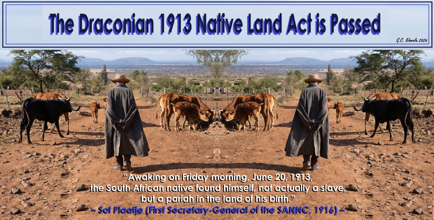
The Draconian 1913 Native Land Act is Passed
On 19 June 1913, the Natives Land Act (No. 27 of 1913) was passed to allocate only about 7% of arable land to Africans and leave the more fertile land for whites. This law incorporated territorial segregation into legislation for the first time since the Union of South Africa was declared in 1910. It created reserves for Blacks and prohibited the sale of territory in white areas to Black people and vice versa. According to debates in Parliament, the Act was passed in order to limit friction between White and Black, but Black people maintained that its aim was to meet demands from White farmers for more agricultural land and to force Blacks to work as their labourers.
An annexure designated the territory initially allocated to Blacks, with a provision that a commission was to investigate the matter further for a more realistic delimitation. In effect, over 80% went to White people, who made up less than 20% of the population. The Act further stipulated that Black people could live outside the reserves only if they could prove that they were in employment. According to Sol Plaatje, the First Secretary-General of the SANNC, “Awaking on Friday morning, June 20, 1913, the South African native found himself, not actually a slave, but a pariah in the land of his birth.”
Although the law was applicable to the whole of South Africa, in practice it applied only to the Transvaal and Natal. In the Free State, such legislation was already in force since 1876, while a law forbidding Blacks to own property in the Cape would have been in conflict with the constitution of the Union of South Africa, as Cape property-ownership was one of the qualifications for Black franchise. Sharecropping on farms in the Transvaal and the Orange Free State was forbidden.
In analysis, the Natives Land Act of 1913 was instituted to legally enforce territorial segregation and restrict Black land ownership to designated “reserves”, initially comprising just 7% of the country. The ultimate goal was to strip Black South Africans of their economic independence to create a constant supply of cheap, migrant labour for white-owned farms and mines. Therefore, by forbidding independent farming, sharecropping and land purchases outside the reserves, the primary objectives of the colonial government was to force Black South Africans to become exploitable, low-wage labourers.
The colonial state sought to officially divide the population along racial lines, confining the majority of the Black population to overcrowded, ethno-defined and less fertile land. The law was designed to eliminate economic competition from Black farmers and prevent white farmers from losing their labour supply to independent Black agricultural production. The land designated for Black South Africans was defined along ethnic lines as a deliberate “divide and rule” strategy to prevent a unified Black political resistance. While the 1913 Natives Land Act set up the initial geographic boundaries of the reserves, subsequent white-minority governments formalised these boundaries into distinct ethnic “homelands” (Bantustans).
The minority government used ethnic division to achieve several critical political and social objectives. By sorting the Black majority into distinct, ethnically defined territories, such as KwaZulu for Zulu people or Transkei for Xhosa people, etc., the state actively hindered the formation of a unified African national identity that could collectively challenge white minority rule.
The colonial state set up separate administrative structures for each ethnic group, forcing traditional leaders and local authorities to compete against one another for scarce resources, effectively diverting political grievances away from the central Pretoria government. Defining the land ethnically allowed the apartheid regime to falsely claim that they were not practicing racial oppression, but were instead promoting “separate development” – giving each distinct cultural group its own space to preserve its language and identity. Traditional leaders (chiefs) were used by the state as low-cost administrative agents to control populations and enforce colonial and apartheid laws from within the territories.
By co-opting the existing tribal hierarchy, the white-minority government created a system of indirect rule that gave repressive state policies a veneer of traditional legitimacy. The state stripped chiefs of their hereditary independence by passing laws like the Native Administration Act of 1927, which made the South African Governor-General the “Supreme Chief” of all Africans. The government gained the legal power to appoint cooperative chiefs, depose rebellious ones, and control their salaries, effectively turning them into civil servants.
Under the Bantu Authorities Act of 1951, the state established tribal, regional, and territorial authorities headed by these co-opted chiefs. They were tasked with collecting taxes, allocating land, managing local dipping tanks and maintaining infrastructure on behalf of the central government. Chiefs were forced to act as gatekeepers for the migrant labor system. They controlled the allocation of land inside the reserves, which they could withhold from families if young men refused to sign labor contracts for white-owned mines and farms. They also helped enforce influx control regulations to keep “unauthorized” Africans out of urban areas.
The state granted chiefs judicial powers to try minor offenses and maintain order. Cooperative chiefs used this power, backed by state police force, when necessary, to ban political meetings, banish political activists, and suppress liberation movements like the African National Congress (ANC) within the territories. The Act devastated Black South Africans, systematically destroying the peasantry and trapping the working class in an inescapable cycle of poverty. By overnight criminalising the livelihoods of millions, the state successfully engineered a desperate, low-wage labour pool.
The Act instantly outlawed sharecropping and cash-tenant farming on white-owned land, turning independent, prosperous Black farmers into illegal squatters or poorly paid farm labourers. Evicted families were forced onto roads with their cattle. Having nowhere to graze them, millions of livestock died or were sold to white farmers for fractions of their true value. Deprived of subsistence land, young men had no choice but to sign exploitative contracts with gold and coal mines, locking the Black working class into a cheap labour system. Because the reserves could not sustain life and workers were legally barred from seeking better jobs in cities without a pass, mining houses and white farmers kept wages artificially low.
Forcing over 80% of the population onto 7% of the least fertile land caused immediate environmental degradation, soil erosion, food insecurity and widespread starvation. The migrant labour system forced men to live in single-sex mine compounds for up to 11 months a year, fracturing marriages, isolating parents and leaving women to manage households alone. Thousands of families wandered the countryside during the bitter winter of 1913 with no shelter, a tragic reality famously documented by Sol Plaatje in his book “Native Life in South Africa”. The combination of overcrowding, lack of clean water, and extreme poverty in the newly formed reserves led to catastrophic spikes in preventable childhood diseases and infant deaths.
The immediate reaction of the only African movement in Southern Africa, the South African Native National Congress (SANNC) – which was later renamed the African National Congress (ANC) – focused on diplomatic pressure, formal petitions and appeals to the British Imperial Government. Because the organisation was only a year old and led by Western-educated elite and traditional leaders, they favoured constitutional agitation over militant resistance. On 9 May 1913, right before the bill became law, the SANNC organised its first major protest meeting at the St. James Masonic Hall in Cape Town to register African objections. Subsequent mass meetings were called across the country to share testimonies of families being evicted.
The SANNC sent formal deputations to Cape Town to meet with the Minister of Native Affairs and Parliamentarians, begging Prime Minister Louis Botha’s government to suspend the bill. They also petitioned Governor-General Lord Gladstone to withhold his royal assent. Both attempts were flatly rejected. Realising the local government would not budge, the SANNC convened a conference in Johannesburg and raised funds to bypass Pretoria entirely.
In June 1914, a select diplomatic delegation travelled to London to appeal directly to the British Crown and Imperial Parliament. The delegation included prominent leaders, such as John Dube (SANNC President), Sol Plaatje (SANNC Secretary-General), Dr Walter Rubusana, Saul Msane and Thomas Mapikela. The SANNC successfully lobbied Christian missionary societies in South Africa – including the Anglican, Wesleyan, Congregational, Baptist, and Presbyterian churches – who passed their own formal resolutions condemning the Act. They also partnered with the British-based Anti-Slavery and Aborigines Protection Society to apply pressure in London.
Sol Plaatje immediately went on the “warpath” with his pen. He travelled across rural South Africa on a bicycle to secretly document the horrific realities of families evicted by the Act. This field research was compiled into his seminal 1916 book, which served as a powerful international propaganda tool against the Union government. However, the British Secretary of State for the Colonies, Lewis Harcourt, received the delegation but refused to intervene, claiming the British government could not interfere in the internal legislative affairs of a self-governing Union. The outbreak of World War I further distracted the British public, causing the diplomatic mission to fail and forcing the SANNC to realise that appeals to British justice were futile.
Following the failure of the 1914 and the subsequent 1919 SANNC diplomatic missions to London, the British government maintained its policy of non-interference. This gave the Union of South Africa, and later the apartheid state, a free hand to entrench, expand, and aggressively build upon the 1913 Natives Land Act for nearly eight decades. The initial 7% allocation of land was universally recognised as completely unsustainable. Rather than walking back the policy, the Hertzog government passed the Development Trust and Land Act of 1936 (initially called the Native Trust and Land Act). This law slightly increased the maximum land allocation for Black South Africans to 13% of the country, leaving the remaining 87% exclusively for the white minority. It also placed stricter regulations on the few remaining Black “tenants” on white farms.
When the National Party came to power in 1948, the 1913 Land Act served as the blueprint for “Grand Apartheid”. The state used it as a foundational stepping stone to pass a web of even more restrictive laws. For instance, the Group Areas Act of 1950 extended racial segregation to urban areas, leading to the forced removal of millions from vibrant inner-city communities, like District Six in Cape Town, Cato Manor in Durban and Sophiatown in Johannesburg, into isolated, racially segregated townships. The Natives Urban Areas Act of 1923 and the Pass Laws strictly controlled the movement of Black people into white cities, making it illegal for them to be in urban spaces without active employment stamps in their passbooks.
As established by the Bantu Authorities Act of 1951, the 13% of reserve land was fragmented into ten ethnically defined Bantustans or “homelands”. Between the 1960s and 1980s, the apartheid regime stripped millions of Black South Africans of their South African citizenship, converting them into legal foreigners within their own country. The 1913 Natives Land Act remained active law for 78 years. Amidst escalating civil unrest, international sanctions, and impending democratic negotiations, State President F.W. de Klerk’s government formally scrapped the law. On 30 June 1991, the Abolition of Racially Based Land Measures Act 108 of 1991 officially repealed the 1913 Land Act, the 1936 Trust Land Act, and the Group Areas Act, finally ending legal restrictions on land ownership based on race.
Following the first democratic elections in 1994, the new ANC-led government faced the monumental task of reversing this spatial legacy. The post-apartheid government passed the Restitution of Land Rights Act of 1994, which established the Commission on Restitution of Land Rights and a Land Claims Court. This allowed individuals and communities who were forcibly removed after 19 June 1913 to lodge claims to either get their ancestral land back or receive financial compensation. Despite these legislative reversals, the spatial planning legacy of the 1913 Act heavily persists today, with working-class Black communities still largely living on the far peripheries of major South African cities.
The District Development Model (DDM) is theoretically a better approach to overcoming South Africa’s fragmented spatial legacy, but in practice, its ability to drive meaningful land reform remains severely limited by institutional silos and local governance failures. Introduced as an intergovernmental “One Plan, One Budget” framework, the DDM directly targets the geographic lines drawn by colonial and apartheid-era planning. Whether it can serve as a panacea depends entirely on bridging the gap between its progressive design and its messy ground-level implementation.
The model provides a highly strategic blueprint that addresses the structural flaws of previous post-apartheid land and urban planning attempts. Historically, the Department of Land Reform and Rural Development, the Department of Human Settlements, and local municipalities operated completely independently. The DDM forces national, provincial and local departments to plan together within 52 designated district and metropolitan “impact zones”. Rather than looking at land reform as a purely rural or agricultural issue, the DDM explicitly aligns land development with the Integrated Urban Development Framework (IUDF), which encourages municipalities to use their “One Plans” to fast-track the release of strategically located state land for affordable inner-city housing and urban agriculture, actively pushing back against the old 1913 spatial boundaries.
A major historical failure of South African land reform has been handing over farms to beneficiaries without giving them the agricultural wherewithal such as water infrastructure, roads or market access needed to succeed. The DDM enables “spatial budgeting”, meaning multiple departments pool resources to build the exact infrastructure required around newly transferred land. By focusing on entire districts rather than isolated towns, the model links rural agrarian land reform directly to nearby urban economic drivers and local markets.
Despite the model’s immense potential, academic and field evaluations, including oversight reports by the National Planning Commission, highlight critical challenges preventing it from transforming land reform. Field studies by institutions like the University of Venda reveal that despite the introduction of the DDM, sector departments frequently continue to run their land reform and agricultural projects in isolation, ignoring the unified district frameworks. The DDM relies on local and district municipalities to drive execution. However, staggering vacancy rates, lack of technical spatial planning skills and financial mismanagement leave many local governments entirely incapable of managing complex land redistribution or infrastructure rollouts.
In former homeland territories, traditional leaders still wield significant authority over communal land allocation under the Spatial Planning and Land Use Management Act (SPLUMA). The DDM has struggled to seamlessly integrate these traditional governance systems into its formal municipal planning models, causing jurisdictional friction. The rollout faces political pushback regarding provincial and metropolitan autonomy – such as legal disputes from the Western Cape government over the centralised nature of the 2024 DDM Regulations – which slows down its uniform application across the country.
Politically strengthening the District Model requires moving it from a mere administrative coordination policy to an enforcement mechanism backed by law, statutory accountability and collaborative governance. Because land reform and spatial planning in South Africa cut across competing national mandates, provincial powers and local execution, the model must be structured to break precisely that political paralysis. The key pathways to politically strengthening the DDM to drive land reform and spatial justice includes codifying the “One Plan” approach into Hard Law.
Currently, the DDM is driven under the Intergovernmental Relations (IGR) Framework Act, meaning its “One Plan, One Budget” directives function primarily as a gentlemen’s agreement. Government must formally pass the proposed DDM Regulations to legally compel national departments, like Land Reform and Human Settlements and state-owned enterprises to align their budgets with district spatial plans. This will stop national ministries from acting as political silos, forcing them to channel land release and agricultural budgets straight into designated municipal target zones.
The political deadlock over who controls communal land in former homelands – the state or traditional chiefs – stalls rural land reform. Want is urgently needed is to establish a statutory co-governance framework by passing targeted amendments to the Spatial Planning and Land Use Management Act (SPLUMA). This would legally integrate traditional councils into municipal DDM planning hubs. Instead of chiefs and mayors clashing over land allocation, traditional leaders would become formal political partners in executing district-led agricultural value chains.
Local coalitions, intra-party factionalism and political patronage frequently derail district-level development plans. What must be done is to enforce the professionalisation of public service by replacing political deployments in DDM technical hubs with merit-based appointments. Deploying permanent, qualified spatial planners, agricultural economists and civil engineers ensures that district land-use plans outlive changing political administrations and fluid local government coalitions.
The DDM faces intense political resistance from opposition-led provinces and metros, such as the Western Cape, that view the model as an unconstitutional power grab by national government. The Minister of Cooperative Governance and Traditional Affairs (CoGTA) must institutionalise the DDM as a tool for coordination, not centralisation. By legally ensuring that the “One Plan” protects municipal autonomy while pooling state resources, metros are incentivised to use tools like the Expropriation Act to fast-track well-located urban land release for affordable housing and other public needs.
Political figures often hide behind poor reporting to mask failures in land delivery and spatial integration. What must happen is to institutionalise the newly developed National Spatial Data Observatory (NSDO) and the Electronic Deeds Registration System (eDRS) directly within DDM oversight bodies. By tracking precisely where land reform budgets are being spent and who owns what in real-time, the state creates an unalterable dashboard that holds district political heads directly accountable for failing to shift the 1913 spatial boundaries.
“With freedom and democracy, came restoration of the right to land. And with it the opportunity to address the effects of centuries of dispossession and denial. At last, we can as a people, look our ancestors in the face and say: Your sacrifices were not in vain” – Nelson Mandela (1995).
Sources:
Wikipedia.
South African History Online (SAHO).
African National Congress, “Resolution against the Natives Land Act 1913 and the Report of the Natives Land Commission, by the South African Native National Congress”, 2 October 1916.
Jeannie van Wyk, “The Legacy of the 1913 Black Land Act for Spatial Planning”, Southern African Public Law, Vol. 28, No. 1, 2013.
Democratic Alliance, “DA Policy on Land Reform”, December 2013.
S. Sizani, “Native Land Act 1913 Legacy Reversal: Parliamentary Oversight and Campaigns”, Land Reform and Rural Development, Parliamentary Monitoring Group, 24 March 2013.
Nonhle Mashinini, “Strategy on District Development Model for the Local Government Sector Education and Training Authority”, LGSETA, 23 March 2021.
Wisdom Mfune, “Land Reforms in South Africa: The Issues and Challenges – Ideology, Politics and Post-Settlement Support Services, PhD Development Studies, University of Pretoria, February 2022.
Byron D. Cannon, “South African Native National Congress Meets”, EBSCO, 2023.
Khuliso Maphiri, “Efficacy of District Development Model in Coordination of Support to Land Redistribution Projects: A Case of Makhado Local Municipality, South Africa”, University of Venda: Master of Urban and Regional Planning, 5 September 2025.
T. Mgweba, “Implementation of the National Spatial Development Framework; DPME Q4 2024/25 Performance and Implementation of BRRR Recommendations”, Planning, Monitoring and Evaluation, Parliamentary Monitoring Group, 4 March 2026.
Velenkosini Hlabisa, “Minister Velenkosini Hlabisa on District Development Model”, Department of Cooperative Governance and Traditional Affairs (CoGTA), 17 March 2026.
Mxolisi B.P. Cebekhulu, et. al., “Tracing the Legacy of the Native Land Act of 1913: A Historical and Contemporary Analysis of Land Reform in the Post-Apartheid South Africa”, Cogent Arts & Humanities, Vol. 13, Issue 1, 2026.
Meg Matthias and the Britannica Editors, “Bantustan: Historical Territory, South Africa”, Encyclopedia Britannica, no date provided.
Castro Khwela
Good morning fellow Compatriots!🙏🏾✊🏾👊🏾
Discover more from CASTRO KHWELA
Subscribe to get the latest posts sent to your email.


